Geolocate

Coyula topographic map

Click on the map to display elevation.

About this map

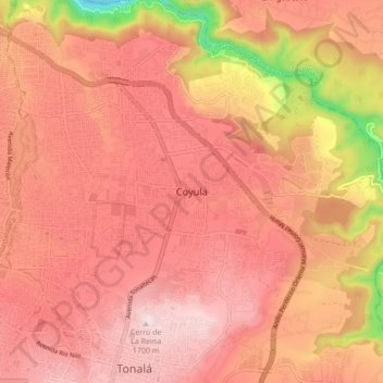
Name: Coyula topographic map, elevation, terrain.

Location: Coyula, Tonalá, Jalisco, 45406, Mexico (20.62115 -103.26929 20.70115 -103.18929)

Average elevation: 1,532 m

Minimum elevation: 1,094 m

Maximum elevation: 1,728 m

Gear up for your next adventure:

🥾Hiking Leggings - Comfortable leggings for outdoor activities
🔦UV Flashlight - Detect minerals or specific insects in the dark
🥾Hiking Gaiters - Protect legs and shoes from mud, snow, and debris
🥾Hiking Shorts - Breathable shorts suitable for summer hikes
🧶550 Survival Paracord - Versatile utility cord for emergency repairs and rigging

As an Amazon Associate, this site earns from qualifying purchases at no extra cost to you.