
Chavin topographic map
Interactive map
Click on the map to display elevation.
About this map
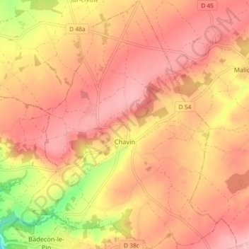
Name: Chavin topographic map, elevation, terrain.
Average elevation: 230 m
Minimum elevation: 119 m
Maximum elevation: 283 m
Other topographic maps
Click on a map to view its topography, its elevation and its terrain.
Condé
France > Centre-Val de Loire > Indre
Condé, Issoudun, Indre, Centre-Val de Loire, Metropolitan France, 36100, France
Average elevation: 152 m
Le Blanc
France > Centre-Val de Loire > Indre
Le Blanc, Indre, Centre-Val de Loire, Metropolitan France, 36300, France
Average elevation: 111 m
Saint-Marcel
France > Centre-Val de Loire > Indre
Saint-Marcel, Châteauroux, Indre, Centre-Val de Loire, Metropolitan France, 36200, France
Average elevation: 149 m