Geolocate

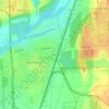
Channahon topographic map

Click on the map to display elevation.

About this map
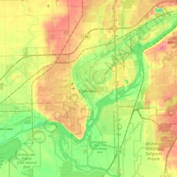
Name: Channahon topographic map, elevation, terrain.

Location: Channahon, Channahon Township, Will County, Illinois, 60410, United States (41.37640 -88.38716 41.48654 -88.17191)

Average elevation: 171 m

Minimum elevation: 132 m

Maximum elevation: 211 m

Other topographic maps

Click on a map to view its topography, its elevation and its terrain.
Drummond

United States > Illinois > Will County

Average elevation: 167 m

Marley

United States > Illinois > Will County

Average elevation: 214 m

Puddle Pond

United States > Illinois > Will County > Plainfield

Average elevation: 187 m

Arbury Hills

United States > Illinois > Will County

Average elevation: 216 m

Gear up for your next adventure:

🥾Trail Hiking Socks - Comfortable socks to prevent blisters and fatigue
💡Solar Camping Lamp - Eco-friendly lighting for campsites
🔦LED Flashlight - Powerful and long-lasting flashlight for camping and emergencies
🗺️Topographic Maps - Detailed maps to explore trails, mountains, and wilderness areas
🧰Survival Kit - Essential gear for emergencies in the wilderness

As an Amazon Associate, this site earns from qualifying purchases at no extra cost to you.