Geolocate

Center Star topographic map

Click on the map to display elevation.

About this map
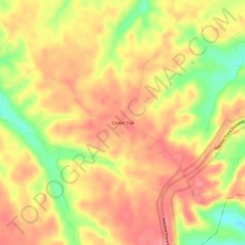
Name: Center Star topographic map, elevation, terrain.

Location: Center Star, Hickman County, Middle Tennessee, Tennessee, 38454, United States (35.67840 -87.34862 35.71840 -87.30862)

Average elevation: 243 m

Minimum elevation: 182 m

Maximum elevation: 279 m

Other topographic maps

Click on a map to view its topography, its elevation and its terrain.
Centerville

United States > Tennessee > Hickman County

Average elevation: 190 m

Gear up for your next adventure:

🛁Quick-Dry Microfiber Towel - Space-saving towel that dries rapidly on the move
🕯️Camping Lantern - Illuminates your entire campsite with high-efficiency LEDs
🧦Merino Wool Socks - Moisture-wicking comfort for long-distance hiking
🥾Lightweight Hiking Boots - Boots for comfort and mobility on long hikes
🥾Hiking Gaiters - Protect legs and shoes from mud, snow, and debris

As an Amazon Associate, this site earns from qualifying purchases at no extra cost to you.