Geolocate

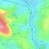
Huttenheim topographic map

Click on the map to display elevation.

About this map

Name: Huttenheim topographic map, elevation, terrain.

Location: Huttenheim, Sélestat-Erstein, Bas-Rhin, Grand Est, Metropolitan France, 67230, France (48.32304 7.53068 48.37430 7.60093)

Average elevation: 160 m

Minimum elevation: 153 m

Maximum elevation: 164 m

Other topographic maps

Click on a map to view its topography, its elevation and its terrain.
Strasbourg

France > Grand Est > Bas-Rhin > Strasbourg

Average elevation: 154 m

Ath

France > Grand Est > Bas-Rhin > Diemeringen

Average elevation: 255 m

Taubensee

France > Grand Est > Bas-Rhin > Niederbronn-les-Bains

Average elevation: 396 m

Le Haut des Monts

France > Grand Est > Bas-Rhin > Belmont

Average elevation: 849 m

Le Climont

France > Grand Est > Bas-Rhin > Urbeis

Average elevation: 621 m

Altenstadt

France > Grand Est > Bas-Rhin > Wissembourg

Average elevation: 172 m

Gear up for your next adventure:

🥾Approach Boots - Comfortable boots for hiking and climbing approaches
🥾Mountain Hiking Boots - High-traction boots for rocky terrain
🥾Trail Hiking Boots - Supportive boots for rough trails
🧊Portable Cooler - Keep food and drinks cold during outdoor adventures
🚲Bike Repair Kit - Essential tools for on-trail mechanical issues

As an Amazon Associate, this site earns from qualifying purchases at no extra cost to you.