Geolocate

Chivay topographic map

Click on the map to display elevation.

About this map

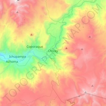
Name: Chivay topographic map, elevation, terrain.

Location: Chivay, Province of Caylloma, Arequipa, 04146, Peru (-15.76305 -71.62473 -15.52093 -71.46877)

Average elevation: 4,430 m

Minimum elevation: 3,239 m

Maximum elevation: 5,579 m

Other topographic maps

Click on a map to view its topography, its elevation and its terrain.

Chinchero

Peru > Arequipa > Caylloma

Average elevation: 4,536 m

Gear up for your next adventure:

🧢Beanie Hat - Keep your head warm in cold weather
🥫Freeze-Dried Meals - Lightweight, high-calorie nutrition for multi-day treks
🥾Trekking Poles - Adjustable trekking poles to reduce knee stress and improve stability
👖Convertible Hiking Pants - Zip-off legs to adapt to changing weather conditions
🚲MTB Frame Bag - Carry tools and maps directly on your bicycle frame

As an Amazon Associate, this site earns from qualifying purchases at no extra cost to you.