Geolocate

Chinchero topographic map

Click on the map to display elevation.

About this map

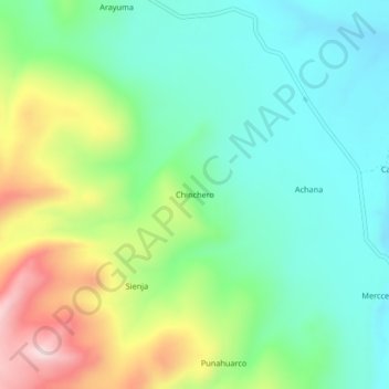
Name: Chinchero topographic map, elevation, terrain.

Location: Chinchero, Caylloma, Province of Caylloma, Arequipa, Peru (-14.95569 -71.88845 -14.91569 -71.84845)

Average elevation: 4,536 m

Minimum elevation: 4,413 m

Maximum elevation: 4,797 m

Gear up for your next adventure:

🔨Vehicle Emergency Tool - Safety tool for remote road trips to trailheads
🧥Fleece Jacket - Warm and lightweight jacket for layering
🧢Outdoor Cap - Protective cap for sun and rain during hikes
🧤Insulated Winter Gloves - Heavy-duty protection for sub-zero Canadian adventures
🥾Lightweight Hiking Shoes - Comfortable shoes for day hikes

As an Amazon Associate, this site earns from qualifying purchases at no extra cost to you.