Geolocate

Naoshima topographic map

Click on the map to display elevation.

About this map

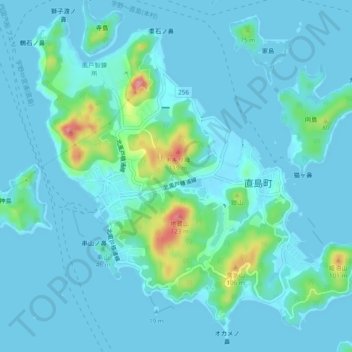
Name: Naoshima topographic map, elevation, terrain.

Location: Naoshima, Kagawa County, Kagawa Prefecture, Japan (34.44229 133.96493 34.47865 134.01264)

Average elevation: 15 m

Minimum elevation: 0 m

Maximum elevation: 112 m

Gear up for your next adventure:

🌬️Windproof Camp Stove - Efficient cooking even on exposed mountain peaks
🧣Merino Neck Gaiter - Protects against wind, sun, and cold at high altitudes
🛌Down Sleeping Bag - Superior warmth-to-weight ratio for cold nights
🕶️Polarized Sunglasses - Reduces glare from snow and water at high elevations
🥾Hiking Shoes - Durable and comfortable shoes for trail hiking

As an Amazon Associate, this site earns from qualifying purchases at no extra cost to you.