Geolocate

Ja-ela topographic map

Click on the map to display elevation.

About this map

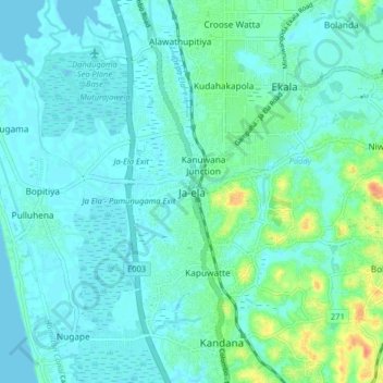
Name: Ja-ela topographic map, elevation, terrain.

Location: Ja-ela, Gampaha District, Western Province, 11350, Sri Lanka (7.03938 79.85076 7.11938 79.93076)

Average elevation: 9 m

Minimum elevation: -1 m

Maximum elevation: 46 m

Gear up for your next adventure:

🛶Canoe Life Vest - Safety vest for water sports
🥾Waterproof Hiking Boots - Essential footwear for rugged terrain and wet Canadian trails
🧤Thermal Hiking Gloves - Grip-enhanced gloves for cold-weather altitude trekking
🥾Hiking Shoes - Durable and comfortable shoes for trail hiking
🛶Kayak Accessories - Essential gear for safe and fun kayaking adventures

As an Amazon Associate, this site earns from qualifying purchases at no extra cost to you.