

Eibar topographic map
Click on the map to display elevation.
Eibar
Eibar lies at an altitude of 121m above sea level, in the west of the province of Gipuzkoa, very close to Biscay. Eibar has an oceanic climate. The town lies in a narrow valley in a mountainous area, with mountains like Karakate, Kalamua and Akondia being between 700 and 800 metres tall. Eibar is traversed by the river Ego, which is a tributary of the Deba.
About this map
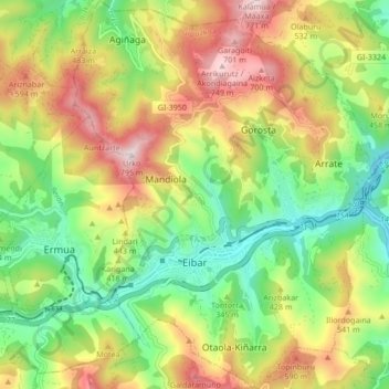
Name: Eibar topographic map, elevation, terrain.
Average elevation: 367 m
Minimum elevation: 74 m
Maximum elevation: 768 m
Other topographic maps
Click on a map to view its topography, its elevation and its terrain.
Karakate
Spain > Autonomous Community of the Basque Country > Debabarrena > Soraluze
Average elevation: 366 m
Iruka
Spain > Autonomous Community of the Basque Country > Debabarrena > Eibar
Average elevation: 425 m
Torrea
Spain > Autonomous Community of the Basque Country > Debabarrena > Eibar
Average elevation: 398 m