Geolocate

Sindangan topographic map

Click on the map to display elevation.

Sindangan

It was also in this same year that the province of Zamboanga was incorporated and the said towns were later transferred to the newly created province out from their mother province of Misamis. However, despite the elevation of Sindangan’s status as a municipal district, it remained unconnected by road to other towns and barrios, making only sea travel as the primary mode of transportation to reach the seat of government in Lubungan.

Wikipedia (CC-BY-SA 3.0)

About this map

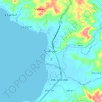
Name: Sindangan topographic map, elevation, terrain.

Location: Sindangan, Zamboanga del Norte, Zamboanga Peninsula, 7112, Philippines (8.19736 122.95861 8.27736 123.03861)

Average elevation: 30 m

Minimum elevation: -2 m

Maximum elevation: 220 m

Other topographic maps

Click on a map to view its topography, its elevation and its terrain.

Sibuco

Philippines > Zamboanga del Norte

Average elevation: 177 m

Dapitan River

Philippines > Zamboanga del Norte

Average elevation: 293 m

Sibuco

Philippines > Zamboanga del Norte

Average elevation: 177 m

Gear up for your next adventure:

🎒Fully Waterproof Backpack - Total protection for photography gear and electronics
🧥Ultralight Puffy Jacket - Maximum warmth that packs down to the size of an orange
🥾Trail Running Shoes - Lightweight and durable shoes for trail running
🥾Lightweight Hiking Boots - Boots for comfort and mobility on long hikes
🥽Outdoor Goggles - Protective eyewear for outdoor activities

As an Amazon Associate, this site earns from qualifying purchases at no extra cost to you.