Geolocate

Calle topographic map

Click on the map to display elevation.

About this map
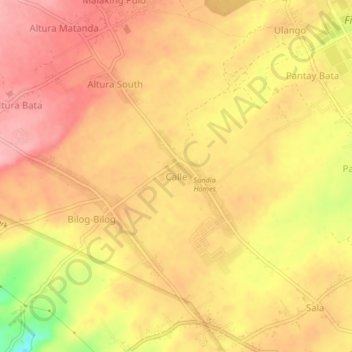
Name: Calle topographic map, elevation, terrain.

Location: Calle, Tanauan, Batangas, Calabarzon, 4232, Philippines (14.09758 121.07560 14.13758 121.11560)

Average elevation: 150 m

Minimum elevation: 64 m

Maximum elevation: 191 m

Gear up for your next adventure:

🧴First Aid Kit - Essential first aid supplies for outdoor emergencies
🥾Lightweight Hiking Shoes - Comfortable shoes for day hikes
🏕️Camping Hammock - Integrated protection for sleeping between trees
👟Trail Running Shoes - Agile footwear for fast-paced topographic exploration
⛺Backpacking Tent - Lightweight tent for long-distance hiking trips

As an Amazon Associate, this site earns from qualifying purchases at no extra cost to you.