Geolocate

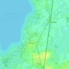
Lemförde topographic map

Click on the map to display elevation.

About this map

Name: Lemförde topographic map, elevation, terrain.

Location: Lemförde, Samtgemeinde Altes Amt Lemförde, Landkreis Diepholz, Lower Saxony, Germany (52.44417 8.33944 52.47812 8.39368)

Average elevation: 54 m

Minimum elevation: 37 m

Maximum elevation: 140 m

Other topographic maps

Click on a map to view its topography, its elevation and its terrain.
Sandbrink

Germany > Lower Saxony > Landkreis Diepholz > Burlage

Average elevation: 38 m

Gear up for your next adventure:

🧢Outdoor Cap - Protective cap for sun and rain during hikes
⛺Camping Groundsheet - Protect your tent from moisture and dirt
🗺️Topographic Maps - Detailed maps to explore trails, mountains, and wilderness areas
⛺Bushcraft Tarp - Versatile emergency shelter or gear protection
🥾Mountain Trail Shoes - High-traction shoes for mountain trails

As an Amazon Associate, this site earns from qualifying purchases at no extra cost to you.