Geolocate

Chokoloskee topographic map

Click on the map to display elevation.

About this map

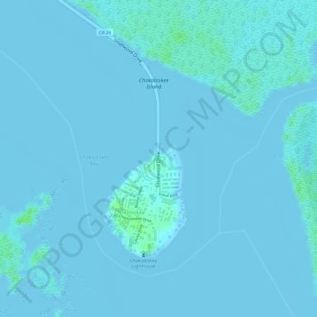
Name: Chokoloskee topographic map, elevation, terrain.

Location: Chokoloskee, Collier County, Florida, United States (25.80891 -81.36452 25.82597 -81.35684)

Average elevation: 1 m

Minimum elevation: -2 m

Maximum elevation: 8 m

Gear up for your next adventure:

🥾Trail Running Shoes - Lightweight and durable shoes for trail running
📷Outdoor Action Camera - Capture high-elevation views and rugged adventures
🛏️Sleeping Bag - Warm and compact sleeping bags for outdoor camping
🧥Softshell Jacket - Windproof and breathable jacket for hiking
🕶️Polarized Sunglasses - Reduces glare from snow and water at high elevations

As an Amazon Associate, this site earns from qualifying purchases at no extra cost to you.