Geolocate

Montseny topographic map

Click on the map to display elevation.

About this map
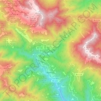
Name: Montseny topographic map, elevation, terrain.

Location: Montseny, Vallès Oriental, Barcelona, Catalonia, 08469, Spain (41.74563 2.33409 41.80871 2.44395)

Average elevation: 993 m

Minimum elevation: 321 m

Maximum elevation: 1,693 m

Gear up for your next adventure:

🔨Vehicle Emergency Tool - Safety tool for remote road trips to trailheads
🧢Sun Hat - Wide-brim hat for sun protection
🥾Hiking Shorts - Breathable shorts suitable for summer hikes
🚑Survival Whistle - Signal for help across long distances in mountains
🐕Hiking Dog Pack - Let your canine companion carry their own water and food

As an Amazon Associate, this site earns from qualifying purchases at no extra cost to you.