Geolocate

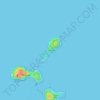
Sinnamary topographic map

Click on the map to display elevation.

About this map

Name: Sinnamary topographic map, elevation, terrain.

Location: Sinnamary, Cayenne, French Guiana, 97315, France (4.98159 -53.21414 5.52761 -52.80590)

Average elevation: 31 m

Minimum elevation: -2 m

Maximum elevation: 363 m

Other topographic maps

Click on a map to view its topography, its elevation and its terrain.

Fedi

France > French Guiana > Apatou

Average elevation: 31 m

Saint Joseph Island

France > French Guiana > Cayenne

Average elevation: 1 m

Devil's Island

France > French Guiana > Cayenne

Average elevation: 1 m

Crique Paracou

France > French Guiana > Sinnamary

Average elevation: 5 m

Tampok

France > French Guiana

Average elevation: 154 m

Lawa

France > French Guiana > Maripasoula

Average elevation: 110 m

Montagne d'Argent

France > French Guiana > Ouanary

Average elevation: 9 m

Dobai

France > French Guiana > Grand-Santi

Average elevation: 39 m

Lawa

France > French Guiana > Maripasoula

Average elevation: 110 m

Gear up for your next adventure:

🧢Beanie Hat - Keep your head warm in cold weather
🔭Compact Binoculars - Lightweight optics for scouting trails and wildlife
👟Leg Gaiters - Keep debris, mud, and snow out of your boots
🥾Trekking Poles - Adjustable trekking poles to reduce knee stress and improve stability
🥾Approach Boots - Comfortable boots for hiking and climbing approaches

As an Amazon Associate, this site earns from qualifying purchases at no extra cost to you.