
Thank you for supporting this site ❤️
Make a donation
Make a donation
Gear up for your next adventure:
As an Amazon Associate, this site earns from qualifying purchases at no extra cost to you.
Nordenham topographic map
Click on the map to display elevation.
Thank you for supporting this site ❤️
Make a donation
Make a donation
Gear up for your next adventure:
As an Amazon Associate, this site earns from qualifying purchases at no extra cost to you.
About this map
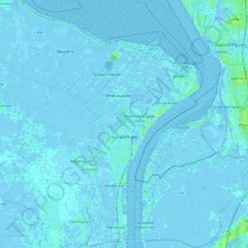
Name: Nordenham topographic map, elevation, terrain.
Location: Nordenham, Landkreis Wesermarsch, Lower Saxony, 26954, Germany (53.43301 8.36258 53.57628 8.55670)
Average elevation: 0 m
Minimum elevation: -7 m
Maximum elevation: 12 m
Thank you for supporting this site ❤️
Make a donation
Make a donation
Gear up for your next adventure:
As an Amazon Associate, this site earns from qualifying purchases at no extra cost to you.