Geolocate

satkhol topographic map

Click on the map to display elevation.

About this map

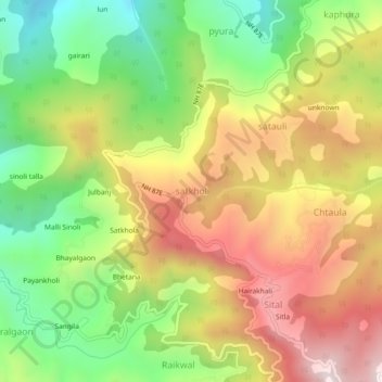
Name: satkhol topographic map, elevation, terrain.

Location: satkhol, Kosya Kutauli, Nainital, Uttarakhand, 263138, India (29.48087 79.60043 29.52087 79.64043)

Average elevation: 1,704 m

Minimum elevation: 1,304 m

Maximum elevation: 2,140 m

Gear up for your next adventure:

🥤Collapsible Travel Cup - Saves space and weight in your mess kit
🥾Durable Hiking Shoes - Long-lasting shoes for frequent hiking
👟Trail Running Shoes - Agile footwear for fast-paced topographic exploration
🍽️Titanium Camping Spork - Ultralight and indestructible eating utensil
💡Compact LED Flashlight - Powerful and portable flashlight for outdoor use

As an Amazon Associate, this site earns from qualifying purchases at no extra cost to you.