
Indian Harbour Beach topographic map
Click on the map to display elevation.
About this map
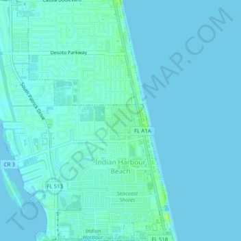
Name: Indian Harbour Beach topographic map, elevation, terrain.
Location: Indian Harbour Beach, Brevard County, Florida, United States (28.13840 -80.61271 28.17233 -80.58073)
Average elevation: 2 m
Minimum elevation: -1 m
Maximum elevation: 13 m
Other topographic maps
Click on a map to view its topography, its elevation and its terrain.
South Patrick Shores
United States > Florida > Brevard County > Satellite Beach
Average elevation: 2 m