Geolocate

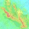
Pekanbaru topographic map

Click on the map to display elevation.

About this map
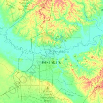
Name: Pekanbaru topographic map, elevation, terrain.

Location: Pekanbaru, Riau, Sumatra, Indonesia (0.41698 101.32606 0.69242 101.59288)

Average elevation: 24 m

Minimum elevation: -1 m

Maximum elevation: 81 m

Other topographic maps

Click on a map to view its topography, its elevation and its terrain.
Bengkalis

Indonesia > Riau > Bengkalis Regency

Average elevation: 3 m

Pangkalan Kerinci Kota

Indonesia > Riau > Pelalawan

Average elevation: 11 m

Pangkalan Kerinci

Indonesia > Riau > Pelalawan

Average elevation: 14 m

Gear up for your next adventure:

🧴Waterproofing Spray - Restore the DWR coating on jackets and tents
🧴Insect Repellent - Protect yourself from bugs during outdoor adventures
🥾Mountain Trail Shoes - High-traction shoes for mountain trails
🔦LED Headtorch - Bright and durable light for night activities
🍽️Titanium Camping Spork - Ultralight and indestructible eating utensil

As an Amazon Associate, this site earns from qualifying purchases at no extra cost to you.