Geolocate

Gablenz - Jabłońc topographic map

Click on the map to display elevation.

About this map

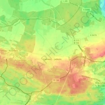
Name: Gablenz - Jabłońc topographic map, elevation, terrain.

Location: Gablenz - Jabłońc, Bad Muskau, Görlitz, Saxony, 02953, Germany (51.51888 14.60318 51.55474 14.69160)

Average elevation: 137 m

Minimum elevation: 104 m

Maximum elevation: 165 m

Gear up for your next adventure:

🧢Hiking Sun Hat - Wide-brimmed protection for exposed mountain ridges
🚲Handlebar Phone Mount - View topographic-map.com live while cycling
🧤Thermal Hiking Gloves - Grip-enhanced gloves for cold-weather altitude trekking
💧Reusable Water Bottle - Durable water bottles for hydration on trails
🧢Sun Hat - Wide-brim hat for sun protection

As an Amazon Associate, this site earns from qualifying purchases at no extra cost to you.