Geolocate

Ronda topographic map

Click on the map to display elevation.

About this map

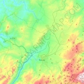
Name: Ronda topographic map, elevation, terrain.

Location: Ronda, Serranía de Ronda, Malaga, Andalusia, Spain (36.67008 -5.29527 36.92104 -4.99532)

Average elevation: 801 m

Minimum elevation: 360 m

Maximum elevation: 1,793 m

Other topographic maps

Click on a map to view its topography, its elevation and its terrain.

La Dehesa

Spain > Andalusia > Serranía de Ronda > Gaucín

Average elevation: 241 m

Gear up for your next adventure:

🔥Emergency Fire Starter - Reliable ignition source for all weather conditions
🔭Compact Monocular - One-handed bird watching and trail spotting
🧢Sun Hat - Wide-brim hat for sun protection
🧴Insect Repellent - Protect yourself from bugs during outdoor adventures
🔥Camping Stove - Portable stoves to cook outdoors with ease

As an Amazon Associate, this site earns from qualifying purchases at no extra cost to you.