Geolocate

Gore topographic map

Click on the map to display elevation.

About this map
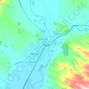
Name: Gore topographic map, elevation, terrain.

Location: Gore, Gore District, Southland, 9740, New Zealand (-46.13845 168.90478 -46.05845 168.98478)

Average elevation: 118 m

Minimum elevation: 61 m

Maximum elevation: 381 m

Gear up for your next adventure:

💧Hydration Bladder - Hands-free hydration solution for long treks
🥾Hiking Leggings - Comfortable leggings for outdoor activities
🕯️Camping Lantern - Illuminates your entire campsite with high-efficiency LEDs
🛌Insulated Sleeping Pad - Critical thermal barrier between you and the cold ground
🔥Camping Stove - Portable stoves to cook outdoors with ease

As an Amazon Associate, this site earns from qualifying purchases at no extra cost to you.