
Make a donation
Gear up for your next adventure:
As an Amazon Associate, this site earns from qualifying purchases at no extra cost to you.
City of Bathurst topographic map
Click on the map to display elevation.
Make a donation
Gear up for your next adventure:
As an Amazon Associate, this site earns from qualifying purchases at no extra cost to you.
About this map
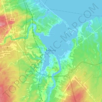
Name: City of Bathurst topographic map, elevation, terrain.
Location: City of Bathurst, Gloucester County, New Brunswick, Canada (47.53236 -65.82651 47.69190 -65.53301)
Average elevation: 42 m
Minimum elevation: -5 m
Maximum elevation: 144 m
Gloucester County trails, hiking, mountain biking, running and outdoor activities
Make a donation
Gear up for your next adventure:
As an Amazon Associate, this site earns from qualifying purchases at no extra cost to you.
Other topographic maps
Click on a map to view its topography, its elevation and its terrain.
Make a donation
Gear up for your next adventure:
As an Amazon Associate, this site earns from qualifying purchases at no extra cost to you.
Saint-Pons
Canada > New Brunswick > Gloucester County > Regional Municipality of Tracadie
Average elevation: 23 m