
Riyadh topographic map
Click on the map to display elevation.
Riyadh
Riyadh has a hot desert climate (Köppen Climate Classification BWh), with long, extremely hot summers and short, very mild winters. The average high temperature in July is 43.9 °C (111.0 °F). If not for its elevation Riyadh would experience an even hotter climate. The city experiences very little precipitation, especially during the summer, but receives a fair amount of rain in March and April. It is also known to have dust storms during which the dust can be so thick that visibility is under 10 m (33 ft). On 1 and 2 April 2015, a massive dust storm hit Riyadh, causing the suspension of classes in many schools in the area and the cancellation of hundreds of flights, both domestic and international.
About this map
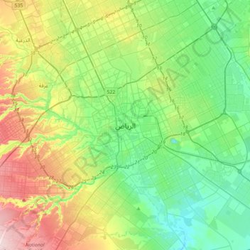
Name: Riyadh topographic map, elevation, terrain.
Location: Riyadh, Riyadh governorate, Riyadh Region, 11131, Saudi Arabia (24.47892 46.55601 24.79892 46.87601)
Average elevation: 630 m
Minimum elevation: 535 m
Maximum elevation: 835 m
Other topographic maps
Click on a map to view its topography, its elevation and its terrain.