Geolocate

Igembe Central topographic map

Click on the map to display elevation.

About this map

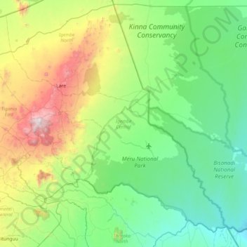
Name: Igembe Central topographic map, elevation, terrain.

Location: Igembe Central, Meru County, Eastern, 60600, Kenya (-0.08967 37.70065 0.54292 38.42083)

Average elevation: 827 m

Minimum elevation: 312 m

Maximum elevation: 2,502 m

Gear up for your next adventure:

Camping Tent - Weather-resistant tents suitable for 2 to 6 people
🧥Waterproof Pants - Keep dry during rainy hiking conditions
🚲MTB Frame Bag - Carry tools and maps directly on your bicycle frame
Camping Coffee Maker - Brew fresh coffee anywhere on the topographic map
🧥Fleece Jacket - Warm and lightweight jacket for layering

As an Amazon Associate, this site earns from qualifying purchases at no extra cost to you.