Geolocate

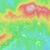
Puig-reig topographic map

Click on the map to display elevation.

About this map

Name: Puig-reig topographic map, elevation, terrain.

Location: Puig-reig, Berguedà, Barcelona, Catalonia, 08692, Spain (41.90609 1.82013 42.00807 1.92575)

Average elevation: 510 m

Minimum elevation: 324 m

Maximum elevation: 731 m

Other topographic maps

Click on a map to view its topography, its elevation and its terrain.

Salselles

Spain > Catalonia > Berguedà > Borredà

Average elevation: 760 m

Serrateix

Spain > Catalonia > Berguedà > Viver i Serrateix

Average elevation: 659 m

l'Ametlla de Merola

Spain > Catalonia > Berguedà > Puig-reig

Average elevation: 410 m

Tubau

Spain > Catalonia > Berguedà > Sant Jaume de Frontanyà

Average elevation: 1,186 m

el Desert del Sàhara

Spain > Catalonia > Berguedà > Sagàs

Average elevation: 548 m

Gear up for your next adventure:

🧣Evaporative Cooling Towel - Beat the heat during intense summer climbs
🔨Vehicle Emergency Tool - Safety tool for remote road trips to trailheads
🥾Durable Hiking Shoes - Long-lasting shoes for frequent hiking
🧶550 Survival Paracord - Versatile utility cord for emergency repairs and rigging
👖Convertible Hiking Pants - Zip-off legs to adapt to changing weather conditions

As an Amazon Associate, this site earns from qualifying purchases at no extra cost to you.