Geolocate

Safaga topographic map

Click on the map to display elevation.

About this map
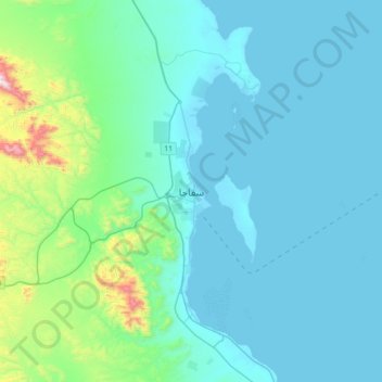
Name: Safaga topographic map, elevation, terrain.

Location: Safaga, Red Sea, 84711, Egypt (26.60333 33.77838 26.92333 34.09838)

Average elevation: 125 m

Minimum elevation: 0 m

Maximum elevation: 1,032 m

Gear up for your next adventure:

🧭GPS Tracker - Track your location in remote areas safely
🥤Collapsible Travel Cup - Saves space and weight in your mess kit
🧥Ultralight Puffy Jacket - Maximum warmth that packs down to the size of an orange
🛶Canoe Life Vest - Safety vest for water sports
⛺Camping Tent - Weather-resistant tents suitable for 2 to 6 people

As an Amazon Associate, this site earns from qualifying purchases at no extra cost to you.