Geolocate

Elm Grove topographic map

Click on the map to display elevation.

About this map

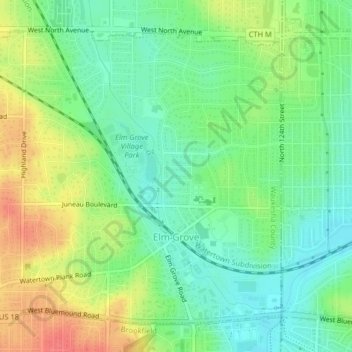
Name: Elm Grove topographic map, elevation, terrain.

Location: Elm Grove, Waukesha County, Wisconsin, United States (43.03581 -88.10723 43.06041 -88.06682)

Average elevation: 240 m

Minimum elevation: 217 m

Maximum elevation: 275 m

Other topographic maps

Click on a map to view its topography, its elevation and its terrain.

Bowron Lake

United States > Wisconsin > Waukesha County > Summit

Average elevation: 269 m

Gear up for your next adventure:

🧳Compression Sacks - Maximize space in your backpack by shrinking gear
Camping Essentials - All-in-one gear for a comfortable camping trip
🥾Hiking Gaiters - Protect legs and shoes from mud, snow, and debris
🦌Outdoor Trail Camera - Monitor wildlife activity near your favorite spots
🪑Insulated Seat Pad - Protect your seat from cold rocks and wet logs

As an Amazon Associate, this site earns from qualifying purchases at no extra cost to you.