Geolocate

Beltran topographic map

Click on the map to display elevation.

About this map

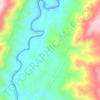
Name: Beltran topographic map, elevation, terrain.

Location: Beltran, Marsella, Risaralda, RAP Eje Cafetero, Colombia (4.95571 -75.79598 5.01127 -75.76016)

Average elevation: 1,078 m

Minimum elevation: 833 m

Maximum elevation: 1,571 m

Gear up for your next adventure:

🥤Collapsible Travel Cup - Saves space and weight in your mess kit
🚲MTB Frame Bag - Carry tools and maps directly on your bicycle frame
🥾Trail Running Shoes - Lightweight and durable shoes for trail running
🧦Thermal Socks - Warm socks for winter hiking or camping
🥘Camping Cookware Set - Compact nesting pots and pans for trail cooking

As an Amazon Associate, this site earns from qualifying purchases at no extra cost to you.