Geolocate

Zarra topographic map

Click on the map to display elevation.

About this map
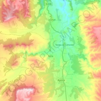
Name: Zarra topographic map, elevation, terrain.

Location: Zarra, El Valle de Cofrentes-Ayora, Valencia, Valencian Community, 46621, Spain (39.07322 -1.21382 39.12421 -1.04162)

Average elevation: 692 m

Minimum elevation: 381 m

Maximum elevation: 1,097 m

Other topographic maps

Click on a map to view its topography, its elevation and its terrain.

Balcó d'Alacant

Spain > Valencian Community > Tibi

Average elevation: 836 m

Gear up for your next adventure:

🧰Survival Kit - Essential gear for emergencies in the wilderness
🔥Emergency Fire Starter - Reliable ignition source for all weather conditions
💧Hydration Bladder - Hands-free hydration solution for long treks
🛌Insulated Sleeping Pad - Critical thermal barrier between you and the cold ground
⛺Backpacking Tent - Lightweight tent for long-distance hiking trips

As an Amazon Associate, this site earns from qualifying purchases at no extra cost to you.