Geolocate

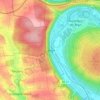
Marktbreit topographic map

Click on the map to display elevation.

About this map

Name: Marktbreit topographic map, elevation, terrain.

Location: Marktbreit, Marktbreit (VGem), Landkreis Kitzingen, Bavaria, 97340, Germany (49.62039 10.08139 49.69108 10.17211)

Average elevation: 260 m

Minimum elevation: 175 m

Maximum elevation: 335 m

Other topographic maps

Click on a map to view its topography, its elevation and its terrain.
Euerfeld

Germany > Bavaria > Landkreis Kitzingen > Dettelbach

Average elevation: 276 m

Enheim

Germany > Bavaria > Landkreis Kitzingen

Average elevation: 290 m

Köhler

Germany > Bavaria > Landkreis Kitzingen > Volkach

Average elevation: 252 m

Langenberg

Germany > Bavaria > Landkreis Kitzingen

Average elevation: 399 m

Gear up for your next adventure:

💧Collapsible Water Bottle - Space-saving water bottle for outdoor activities
👟Sport Hiking Sandals - Breathable footwear for water crossings and camp rest
🎒Hiking Backpack - Lightweight and ergonomic backpacks for day hikes or multi-day treks
🛁Quick-Dry Microfiber Towel - Space-saving towel that dries rapidly on the move
🧴Waterproofing Spray - Restore the DWR coating on jackets and tents

As an Amazon Associate, this site earns from qualifying purchases at no extra cost to you.