Geolocate

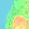
Thorah Island topographic map

Click on the map to display elevation.

About this map

Name: Thorah Island topographic map, elevation, terrain.

Location: Thorah Island, Brock, Durham Region, Ontario, Canada (44.43082 -79.25211 44.45800 -79.21211)

Average elevation: 219 m

Minimum elevation: 216 m

Maximum elevation: 232 m

Other topographic maps

Click on a map to view its topography, its elevation and its terrain.

Cannington

Canada > Ontario > Durham Region > Brock

Average elevation: 263 m

Sunderland

Canada > Ontario > Durham Region > Brock

Average elevation: 277 m

Beaverton

Canada > Ontario > Durham Region > Brock

Average elevation: 231 m

Cannington

Canada > Ontario > Durham Region > Brock

Average elevation: 263 m

Gear up for your next adventure:

🧦Hiking Liner Socks - Thin base layer to prevent friction and blisters
🧴Sunscreen SPF - Broad-spectrum sunscreen for outdoor activities
🛏️Camping Sleeping Mat - Comfortable mats for sleeping outdoors
🕶️Polarized Sunglasses - Protect your eyes with durable polarized lenses
🧦Outdoor Socks - Durable socks designed for hiking and outdoor sports

As an Amazon Associate, this site earns from qualifying purchases at no extra cost to you.