Geolocate

Aschheim topographic map

Click on the map to display elevation.

About this map
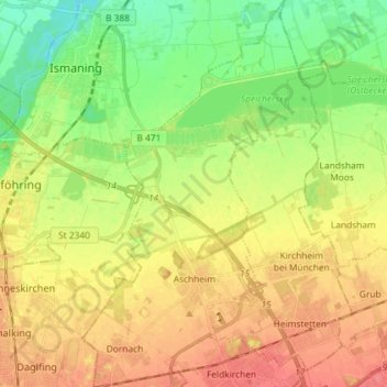
Name: Aschheim topographic map, elevation, terrain.

Location: Aschheim, Landkreis München, Bavaria, 85609, Germany (48.14429 11.67393 48.24110 11.75571)

Average elevation: 504 m

Minimum elevation: 475 m

Maximum elevation: 532 m

Gear up for your next adventure:

💡Compact LED Flashlight - Powerful and portable flashlight for outdoor use
🧴Sunscreen SPF - Broad-spectrum sunscreen for outdoor activities
🎒Hiking Backpack - Lightweight and ergonomic backpacks for day hikes or multi-day treks
🧤Thermal Hiking Gloves - Grip-enhanced gloves for cold-weather altitude trekking
🥾Hiking Gaiters - Protect legs and shoes from mud, snow, and debris

As an Amazon Associate, this site earns from qualifying purchases at no extra cost to you.