Geolocate

Kessingland topographic map

Click on the map to display elevation.

About this map

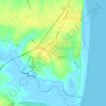
Name: Kessingland topographic map, elevation, terrain.

Location: Kessingland, East Suffolk, Suffolk, England, United Kingdom (52.39925 1.69133 52.43549 1.73232)

Average elevation: 8 m

Minimum elevation: -4 m

Maximum elevation: 24 m

Gear up for your next adventure:

🧊Portable Cooler - Keep food and drinks cold during outdoor adventures
🦯Trekking Poles - Reduced impact on joints for steep topographic climbs
🧥Softshell Hiking Jacket - The perfect balance of wind protection and breathability
🥾Hiking Shoes - Durable and comfortable shoes for trail hiking
🥾Trekking Boots - Durable boots for long-distance trekking

As an Amazon Associate, this site earns from qualifying purchases at no extra cost to you.