Geolocate

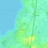
Lembruch topographic map

Click on the map to display elevation.

About this map

Name: Lembruch topographic map, elevation, terrain.

Location: Lembruch, Samtgemeinde Altes Amt Lemförde, Landkreis Diepholz, Lower Saxony, 49459, Germany (52.50647 8.31081 52.54942 8.44813)

Average elevation: 38 m

Minimum elevation: 34 m

Maximum elevation: 49 m

Other topographic maps

Click on a map to view its topography, its elevation and its terrain.
Sandbrink

Germany > Lower Saxony > Landkreis Diepholz > Burlage

Average elevation: 38 m

Gear up for your next adventure:

💧Collapsible Water Bottle - Space-saving water bottle for outdoor activities
🌬️Windproof Camp Stove - Efficient cooking even on exposed mountain peaks
⛺Camping Groundsheet - Protect your tent from moisture and dirt
🧰Multitool Knife - Compact and versatile tool for outdoor use
🥾Trekking Poles - Adjustable trekking poles to reduce knee stress and improve stability

As an Amazon Associate, this site earns from qualifying purchases at no extra cost to you.