Geolocate

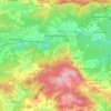
Vilshofen topographic map

Click on the map to display elevation.

About this map
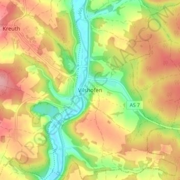
Name: Vilshofen topographic map, elevation, terrain.

Location: Vilshofen, Rieden, Landkreis Amberg-Sulzbach, Bavaria, 92286, Germany (49.27788 11.93297 49.31788 11.97297)

Average elevation: 416 m

Minimum elevation: 354 m

Maximum elevation: 474 m

Other topographic maps

Click on a map to view its topography, its elevation and its terrain.

Hirschau

Germany > Bavaria > Landkreis Amberg-Sulzbach

Average elevation: 476 m

Ensdorf

Germany > Bavaria > Landkreis Amberg-Sulzbach

Average elevation: 436 m

Hohenzant

Germany > Bavaria > Landkreis Amberg-Sulzbach > Vilseck

Average elevation: 460 m

Vilseck

Germany > Bavaria > Landkreis Amberg-Sulzbach

Average elevation: 442 m

Gear up for your next adventure:

🛁Quick-Dry Microfiber Towel - Space-saving towel that dries rapidly on the move
🎒Fully Waterproof Backpack - Total protection for photography gear and electronics
🛰️Satellite Messenger - Emergency communication for areas with no cell service
🥾Waterproof Hiking Boots - Essential footwear for rugged terrain and wet Canadian trails
🧴Sunscreen SPF - Broad-spectrum sunscreen for outdoor activities

As an Amazon Associate, this site earns from qualifying purchases at no extra cost to you.