Geolocate

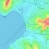
Newcastle topographic map

Click on the map to display elevation.

About this map

Name: Newcastle topographic map, elevation, terrain.

Location: Newcastle, Newcastle-Maitland, City of Newcastle, New South Wales, 2300, Australia (-32.93781 151.75967 -32.90148 151.80393)

Average elevation: 5 m

Minimum elevation: -3 m

Maximum elevation: 76 m

Other topographic maps

Click on a map to view its topography, its elevation and its terrain.
Gear up for your next adventure:

❄️Traction Ice Cleats - Slip-on spikes for icy trails and winter hiking
🥾Hiking Shorts - Breathable shorts suitable for summer hikes
💧Filtered Water Bottle - Safe drinking water on the go
🧳Compression Sacks - Maximize space in your backpack by shrinking gear
🩹Compact First Aid Kit - Pre-packed essentials for common trail injuries

As an Amazon Associate, this site earns from qualifying purchases at no extra cost to you.