Geolocate

Macomb topographic map

Click on the map to display elevation.

About this map
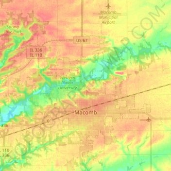
Name: Macomb topographic map, elevation, terrain.

Location: Macomb, McDonough County, Illinois, 61455, United States (40.43110 -90.75720 40.51983 -90.61879)

Average elevation: 207 m

Minimum elevation: 176 m

Maximum elevation: 226 m

Other topographic maps

Click on a map to view its topography, its elevation and its terrain.

Adair

United States > Illinois > McDonough County

Average elevation: 198 m

Gear up for your next adventure:

💧Filtered Water Bottle - Safe drinking water on the go
🥘Camping Cookware Set - Compact nesting pots and pans for trail cooking
🔭Outdoor Binoculars - Lightweight binoculars for birdwatching and hiking
🪜Heavy Duty Carabiners - Multi-use clips for securing gear to your backpack
🧦Hiking Liner Socks - Thin base layer to prevent friction and blisters

As an Amazon Associate, this site earns from qualifying purchases at no extra cost to you.