Geolocate

Willowbrook topographic map

Click on the map to display elevation.

About this map

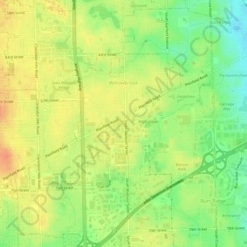
Name: Willowbrook topographic map, elevation, terrain.

Location: Willowbrook, DuPage County, Illinois, United States (41.74269 -87.96430 41.78330 -87.92323)

Average elevation: 219 m

Minimum elevation: 195 m

Maximum elevation: 237 m

Gear up for your next adventure:

📷Outdoor Action Camera - Capture high-elevation views and rugged adventures
🎒Backpack Rain Cover - External shield to keep your entire pack dry
🧦Outdoor Socks - Durable socks designed for hiking and outdoor sports
🥾Approach Boots - Comfortable boots for hiking and climbing approaches
Camping Coffee Maker - Brew fresh coffee anywhere on the topographic map

As an Amazon Associate, this site earns from qualifying purchases at no extra cost to you.