Geolocate

Coachman topographic map

Click on the map to display elevation.

About this map
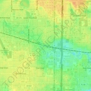
Name: Coachman topographic map, elevation, terrain.

Location: Coachman, Clearwater, Pinellas County, Florida, 33765, United States (27.95780 -82.75788 27.99780 -82.71788)

Average elevation: 19 m

Minimum elevation: 0 m

Maximum elevation: 33 m

Other topographic maps

Click on a map to view its topography, its elevation and its terrain.
Gear up for your next adventure:

🧢Hiking Hat - Sun-protective and breathable hats for long treks
🧢Sun Hat - Wide-brim hat for sun protection
⛺Camping Essentials - All-in-one gear for a comfortable camping trip
🧥Waterproof Jacket - Lightweight rain jackets for hiking and outdoor activities
🚲Bike Repair Kit - Essential tools for on-trail mechanical issues

As an Amazon Associate, this site earns from qualifying purchases at no extra cost to you.