Geolocate

Konya topographic map

Click on the map to display elevation.

About this map
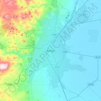
Name: Konya topographic map, elevation, terrain.

Location: Konya, Selçuklu, Konya, Central Anatolia Region, 42200, Turkey (37.71273 32.33244 38.03273 32.65244)

Average elevation: 1,160 m

Minimum elevation: 999 m

Maximum elevation: 2,052 m

Other topographic maps

Click on a map to view its topography, its elevation and its terrain.

Sille Mahallesi

Turkey > Selçuklu

Average elevation: 1,267 m

Aşağıpınarbaşı Mahallesi

Turkey > Selçuklu

Average elevation: 1,027 m

Gear up for your next adventure:

🧥Waterproof Pants - Keep dry during rainy hiking conditions
🧢Outdoor Cap - Protective cap for sun and rain during hikes
⛺Backpacking Tent - Lightweight tent for long-distance hiking trips
🦯Trekking Poles - Reduced impact on joints for steep topographic climbs
🥾Waterproof Hiking Boots - Essential footwear for rugged terrain and wet Canadian trails

As an Amazon Associate, this site earns from qualifying purchases at no extra cost to you.