Geolocate

Garabandal topographic map

Click on the map to display elevation.

About this map

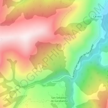
Name: Garabandal topographic map, elevation, terrain.

Location: Garabandal, Rionansa, Cantabria, 39554, Spain (43.20255 -4.43504 43.22255 -4.41504)

Average elevation: 611 m

Minimum elevation: 239 m

Maximum elevation: 965 m

Gear up for your next adventure:

🧢Sun Protection Cap - Breathable cap to protect from sun exposure
🥾Waterproof Hiking Boots - Essential footwear for rugged terrain and wet Canadian trails
🧣Evaporative Cooling Towel - Beat the heat during intense summer climbs
🧴Bear Spray Holster - Quick-access carry for essential Canadian wilderness safety
🥾Lightweight Hiking Shoes - Comfortable shoes for day hikes

As an Amazon Associate, this site earns from qualifying purchases at no extra cost to you.