
Kuna topographic map
Click on the map to display elevation.
About this map
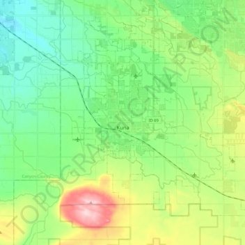
Name: Kuna topographic map, elevation, terrain.
Location: Kuna, Ada County, Idaho, United States (43.42879 -116.46353 43.56115 -116.25419)
Average elevation: 830 m
Minimum elevation: 762 m
Maximum elevation: 982 m
Other topographic maps
Click on a map to view its topography, its elevation and its terrain.
Boise
United States > Idaho > Ada County
Boise (locally /ˈbɔɪsi/ BOY-see) is the capital and most populous city of the U.S. state of Idaho and is the county seat of Ada County. As of the 2020 census, there were 235,684 people residing in the city. On the Boise River in southwestern Idaho, it is 41 miles (66 km) east of the Oregon border and 110…
Average elevation: 1,040 m