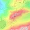
Quinto topographic map
Click on the map to display elevation.
Quinto
The municipality is located in the Leventina district, along both sides of the upper Leventina valley. The borders stretch all the way from the peaks above the valley, at an elevation of over 2,800 m (9,200 ft), to the valley at 1,011 m (3,317 ft). It consists of the village of Quinto and the village sections of Altanca, Ambrì, Catto, Deggio, Piotta and Varenzo. The municipalities of Airolo and Quinto are considering a merger some time in the future into a new municipality which will be known as Airolo-Quinto.
About this map

Name: Quinto topographic map, elevation, terrain.
Average elevation: 1,911 m
Minimum elevation: 707 m
Maximum elevation: 2,976 m
Other topographic maps
Click on a map to view its topography, its elevation and its terrain.

Bodio TI
Switzerland > Ticino > Distretto di Leventina
The municipality is located in the Leventina district, at an elevation of 321 m (1,053 ft) on the left side of the lower Leventina valley.
Average elevation: 875 m
Chironico
Switzerland > Ticino > Distretto di Leventina
The municipality is located in the Leventina district, on the right slope of the mid-Leventina valley at an elevation of 786 meters (2,579 ft). The municipality stretches from the Ticino river at the Biaschina-Schlucht (elevation 450 m (1,480 ft)) up to the Pizzo Campo Tencia (3,072 m (10,079 ft)) in the upper…
Average elevation: 1,026 m
Chironico
Switzerland > Ticino > Distretto di Leventina
The municipality is located in the Leventina district, on the right slope of the mid-Leventina valley at an elevation of 786 meters (2,579 ft). The municipality stretches from the Ticino river at the Biaschina-Schlucht (elevation 450 m (1,480 ft)) up to the Pizzo Campo Tencia (3,072 m (10,079 ft)) in the upper…
Average elevation: 1,026 m