
Isla Navarino topographic map
Click on the map to display elevation.
About this map
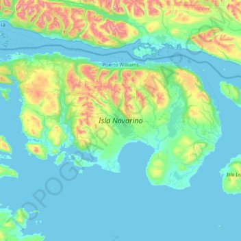
Name: Isla Navarino topographic map, elevation, terrain.
Average elevation: 172 m
Minimum elevation: 0 m
Maximum elevation: 1,341 m
Other topographic maps
Click on a map to view its topography, its elevation and its terrain.
Cerro Castillo
Chile > Region of Magallanes and Chilean Antarctica > Provincia de Tierra del Fuego > Timaukel
Average elevation: 814 m
Peak
Chile > Region of Magallanes and Chilean Antarctica > Provincia de Magallanes > Punta Arenas
Average elevation: 48 m