
Dothan topographic map
Interactive map
Click on the map to display elevation.
About this map
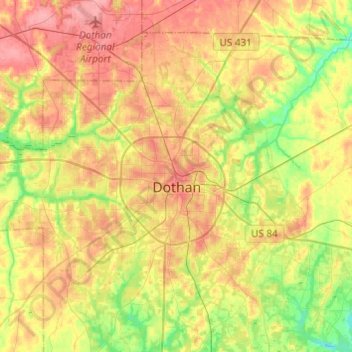
Name: Dothan topographic map, elevation, terrain.
Location: Dothan, Houston County, Alabama, United States (31.12625 -85.51885 31.33396 -85.29432)
Average elevation: 88 m
Minimum elevation: 48 m
Maximum elevation: 125 m