
Make a donation
Gear up for your next adventure:
As an Amazon Associate, this site earns from qualifying purchases at no extra cost to you.
Gößweinstein topographic map
Click on the map to display elevation.
Make a donation
Gear up for your next adventure:
As an Amazon Associate, this site earns from qualifying purchases at no extra cost to you.
About this map
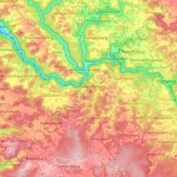
Name: Gößweinstein topographic map, elevation, terrain.
Location: Gößweinstein, Landkreis Forchheim, Bavaria, 91327, Germany (49.71881 11.23286 49.81765 11.38839)
Average elevation: 461 m
Minimum elevation: 307 m
Maximum elevation: 578 m
Make a donation
Gear up for your next adventure:
As an Amazon Associate, this site earns from qualifying purchases at no extra cost to you.
Other topographic maps
Click on a map to view its topography, its elevation and its terrain.
Make a donation
Gear up for your next adventure:
As an Amazon Associate, this site earns from qualifying purchases at no extra cost to you.
Ebermannstadt
Germany > Bavaria > Landkreis Forchheim > Ebermannstadt > Ebermannstadt
Average elevation: 408 m