
Thank you for supporting this site ❤️
Make a donation
Make a donation
Gear up for your next adventure:
As an Amazon Associate, this site earns from qualifying purchases at no extra cost to you.
Riells i Viabrea topographic map
Click on the map to display elevation.
Thank you for supporting this site ❤️
Make a donation
Make a donation
Gear up for your next adventure:
As an Amazon Associate, this site earns from qualifying purchases at no extra cost to you.
About this map
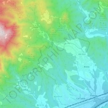
Name: Riells i Viabrea topographic map, elevation, terrain.
Location: Riells i Viabrea, la Selva, Girona, Catalonia, 17404, Spain (41.71907 2.46915 41.79568 2.57193)
Average elevation: 465 m
Minimum elevation: 81 m
Maximum elevation: 1,339 m
Thank you for supporting this site ❤️
Make a donation
Make a donation
Gear up for your next adventure:
As an Amazon Associate, this site earns from qualifying purchases at no extra cost to you.