

Puducherry topographic map
Click on the map to display elevation.
Puducherry
The topography of Pondicherry is the same as that of coastal Tamil Nadu. Pondicherry's average elevation is at sea level and includes a number of sea inlets, referred to locally as "backwaters". Pondicherry experiences extreme coastal erosion as a result of a breakwater constructed in 1989, just to the south of the city. Where there was once a broad, sandy beach, now the city is protected against the sea by a 2-km-long seawall that sits at a height of 8.5 m above sea level. Whilst there was an early seawall made by the French government in 1735, this was not "hard structure coastal defence" so much as an adjunct to the old shipping pier and a transition from the beach to the city.
About this map
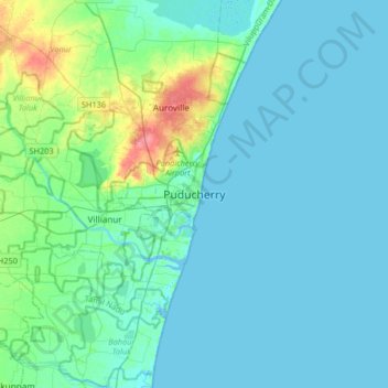
Name: Puducherry topographic map, elevation, terrain.
Average elevation: 10 m
Minimum elevation: -4 m
Maximum elevation: 63 m